![]()
Sailor Croatia
Adriatic Navigation & Weather
Boating on the Adriatic - distance to shore, speed, and heading at a glance.
Boating on the Adriatic? Sailor shows your distance to shore, speed, and heading in real time — live navigation, weather forecasts, and route planning from one place. Follow your route on the lock screen or Apple Watch. Pre-download areas with PRO so everything keeps working in spots with poor signal.
Be more confident before starting your boat trip — route, weather, and fuel in one place.
Download Sailor

⚠️ Safety notice. Sailor is a navigation aid, not a substitute for official charts, a proper lookout, or seamanship. Position, distance, and hazard data are estimates and may be inaccurate, delayed, or incomplete. Sailor has no sea depth data — always verify depth using official nautical charts or a depth sounder. You are solely responsible for safe operation of your vessel and for compliance with local maritime laws. Full terms apply.

Features
Free to use — No ads, No account required
Core features available at no cost.
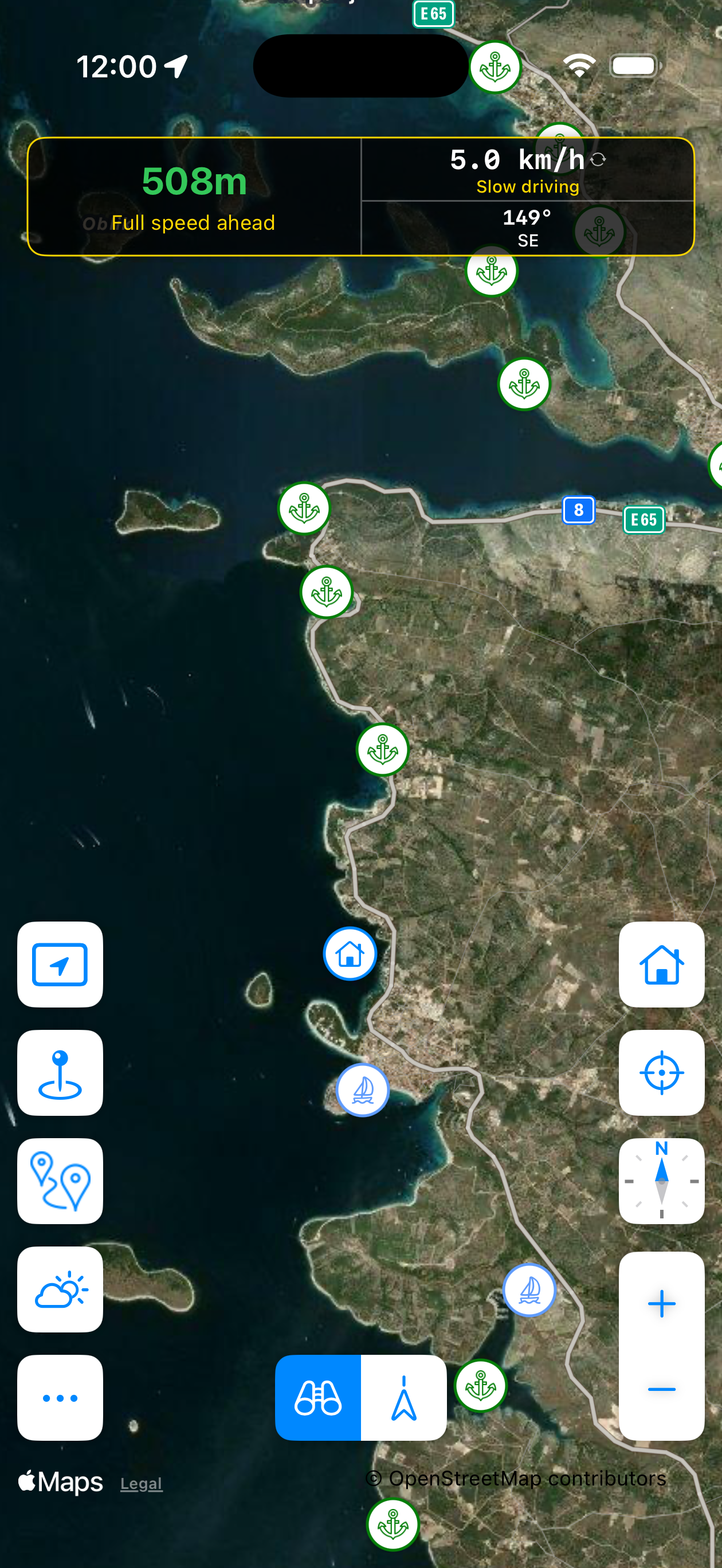
Distance & Speed Tracking
Real-time distance to the nearest detected coastline and your current speed — a live readout of where you stand.
Real-time Navigation
Follow a route with live guidance and estimated arrival times. Follow routes shared by others for free, or plan your own with PRO.
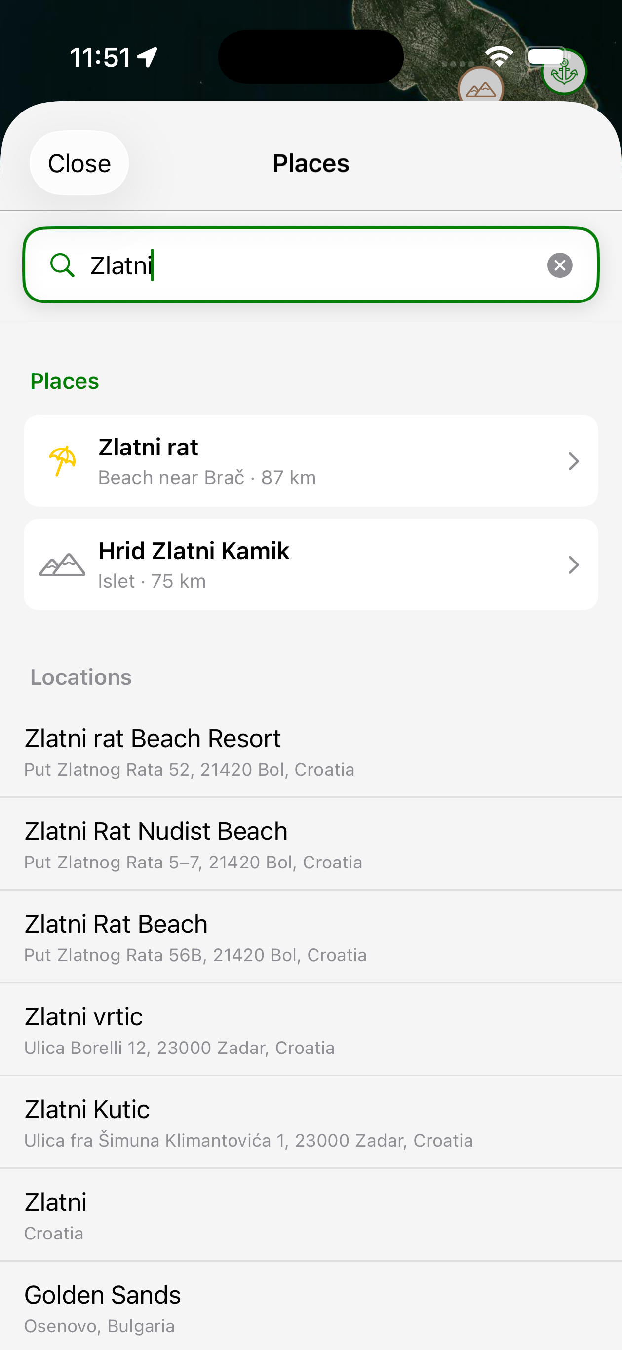
Explore Places
Browse coves, marinas, and beaches across the Adriatic directly on the map.
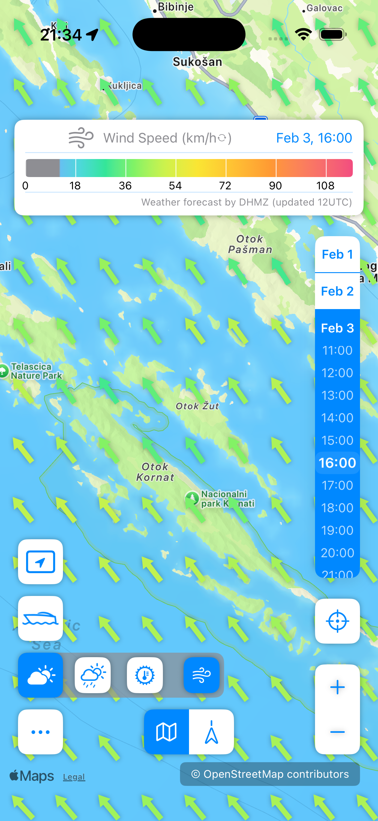
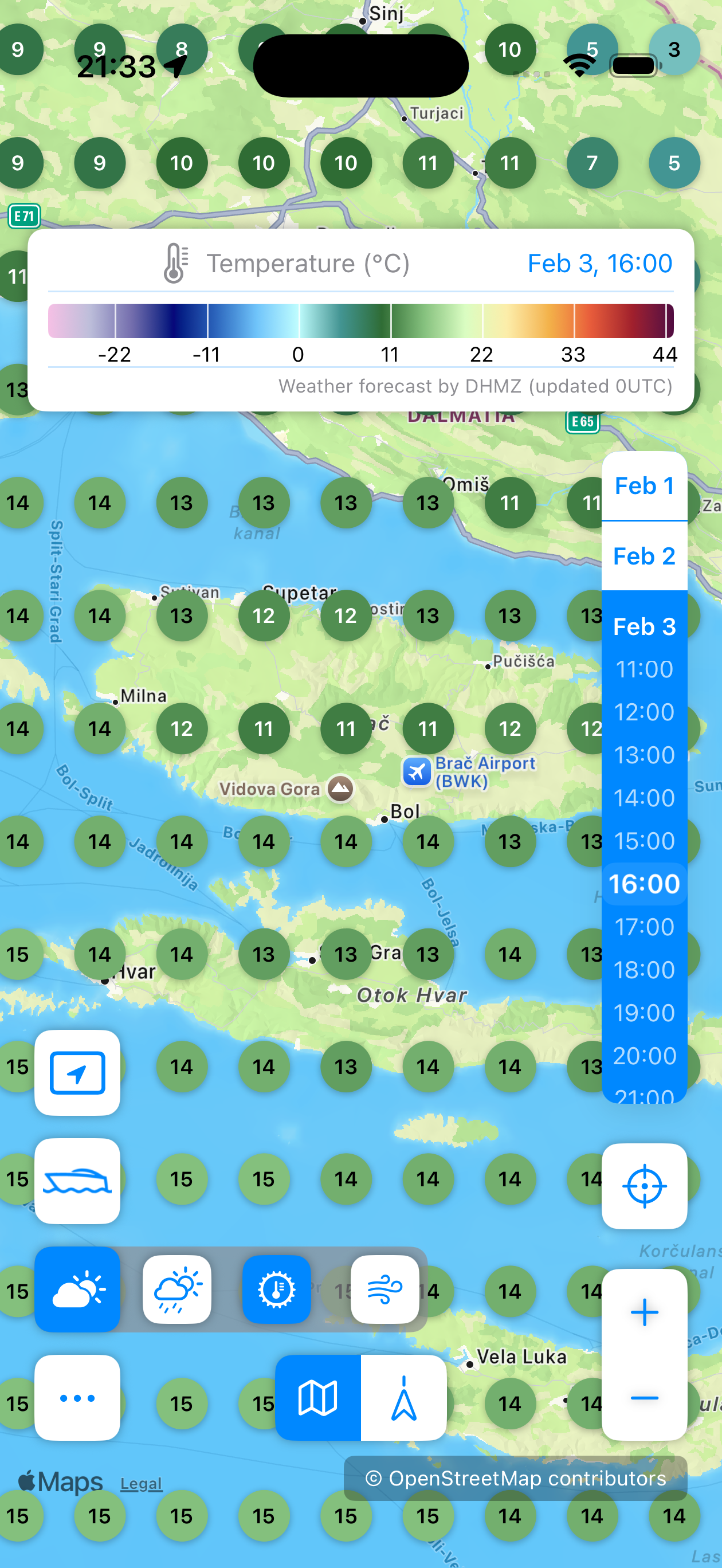
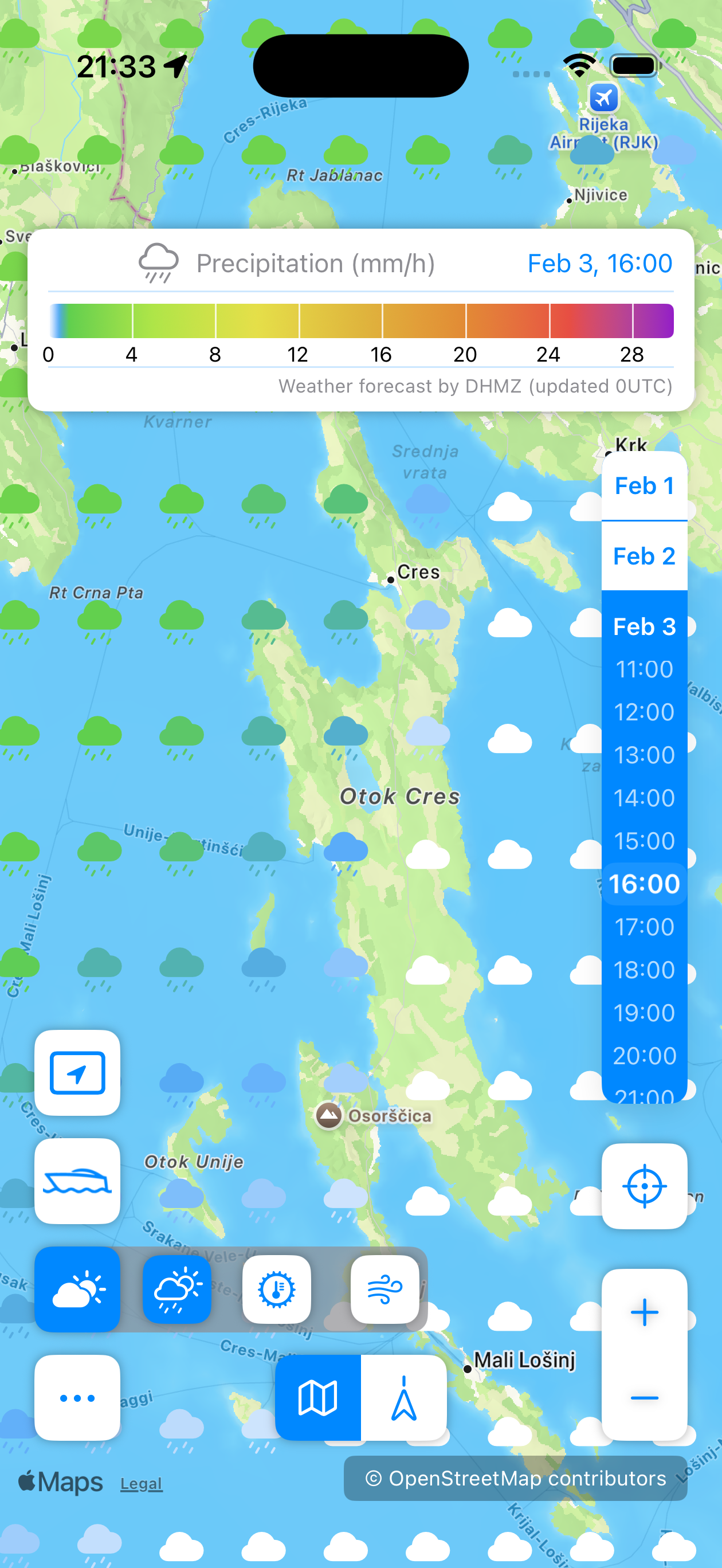
Weather
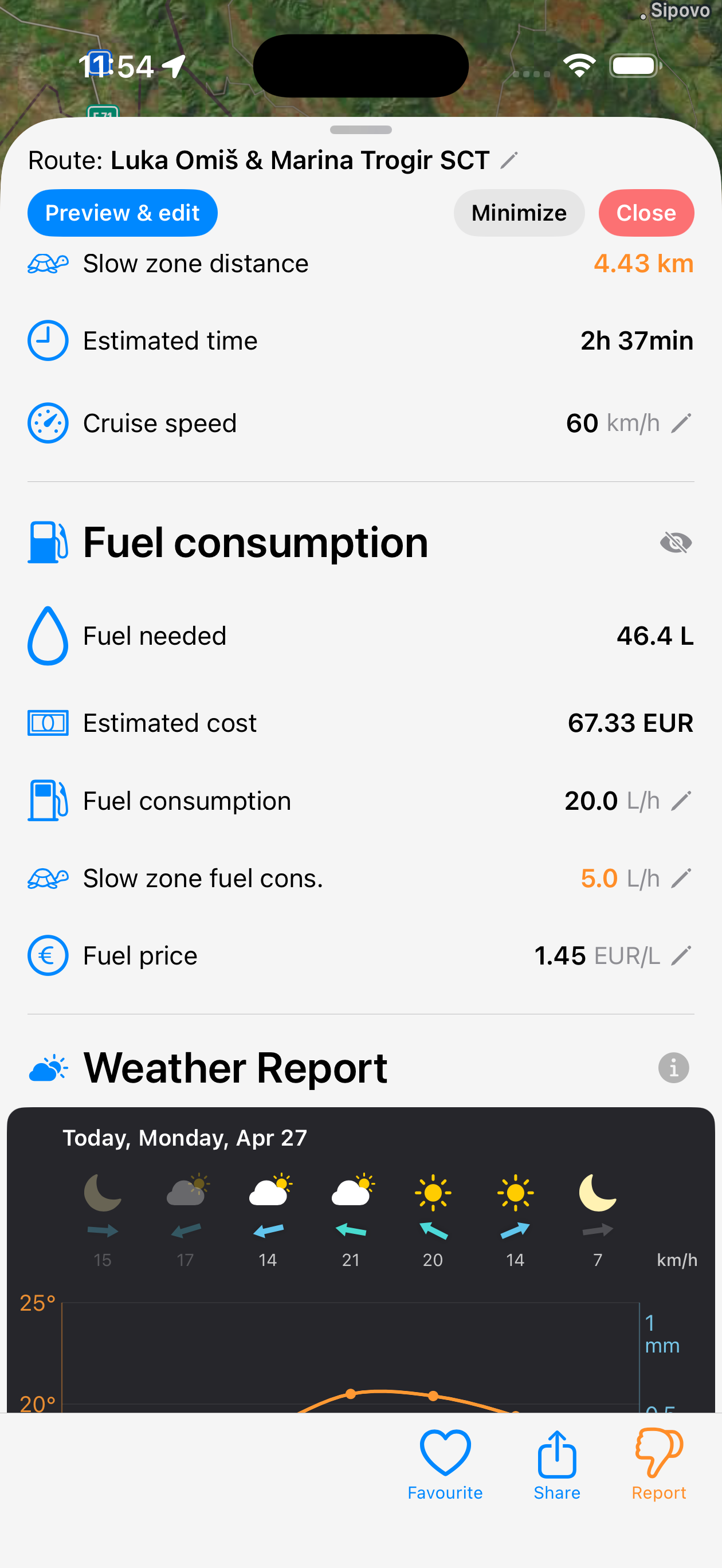
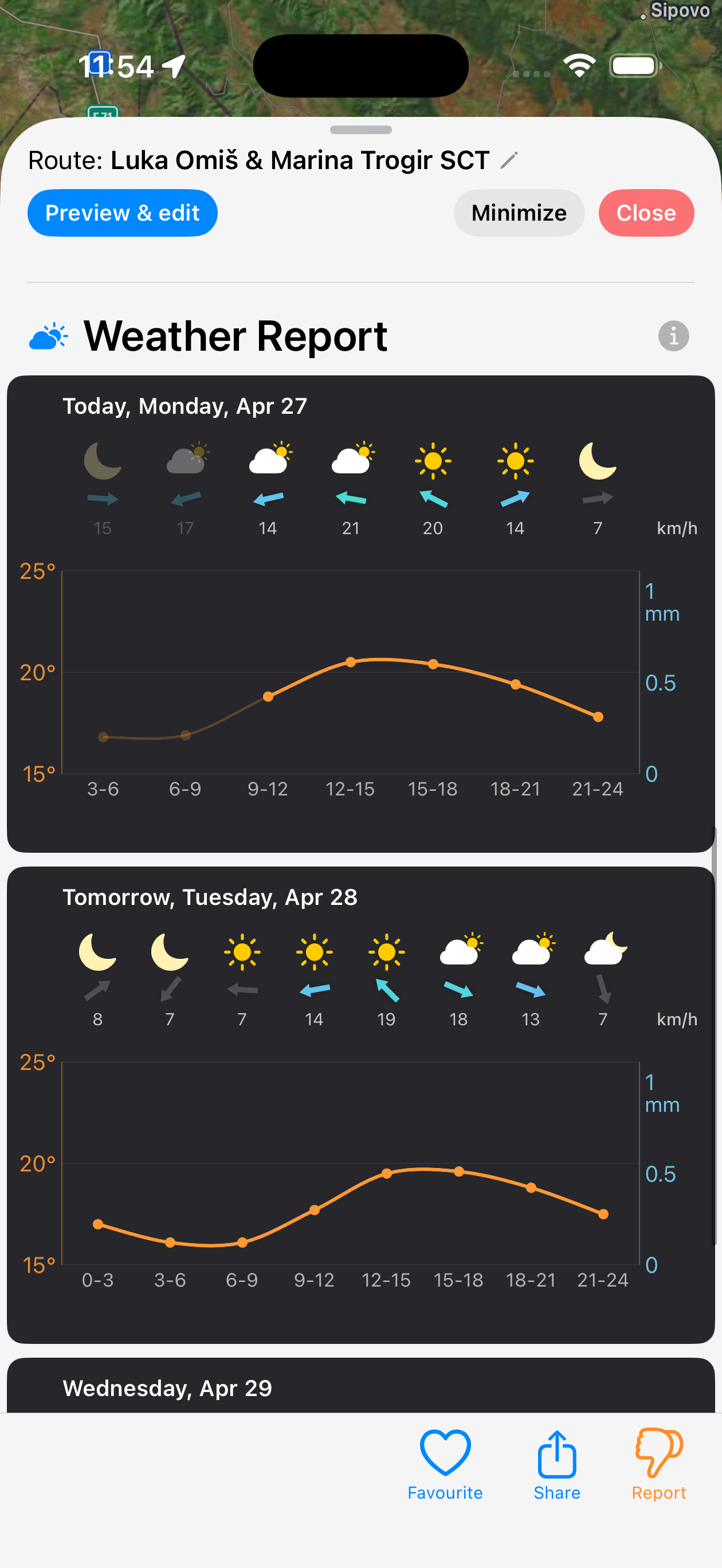
Wind, temperature, and precipitation along your route — sampled from Croatia's local DHMZ ALADIN model rather than a generic global forecast. Wind overlay on the map and conditions at every leg. Works with shared routes or routes planned with PRO.
Go further with PRO
Advanced tools for coastal compliance, navigation, and hands-free guidance.
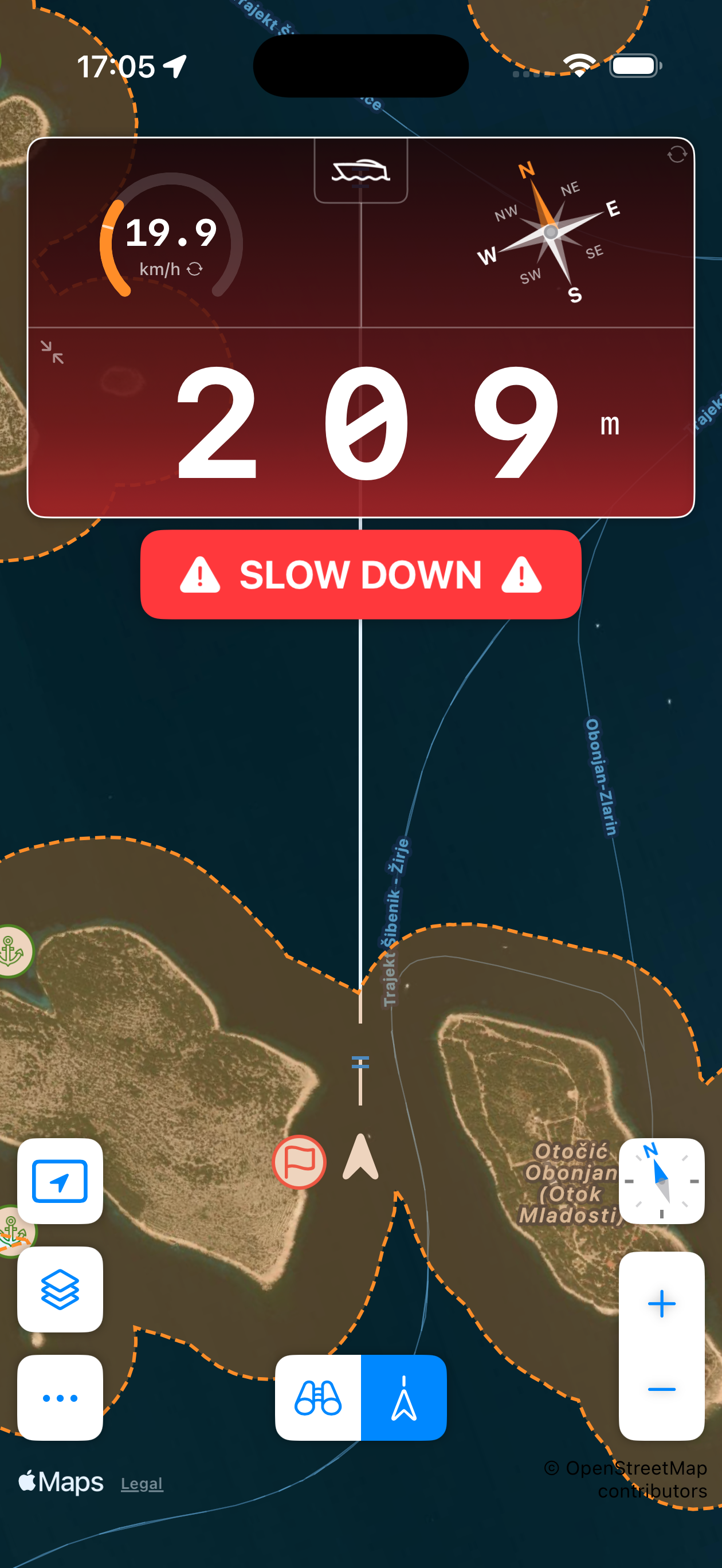
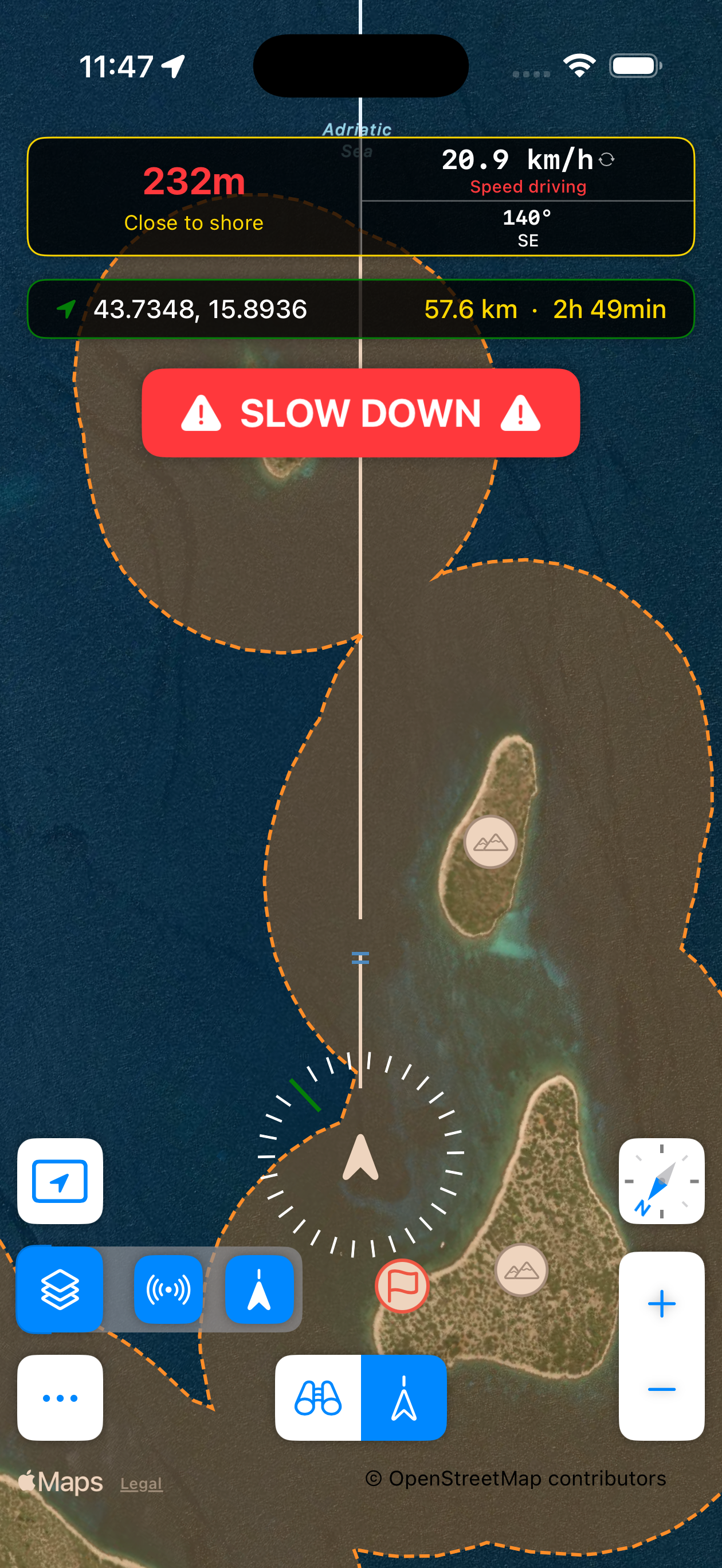
Speed Alerts
Get alerted automatically when you're moving too fast near the coast. Stay aware of the boundary without constantly checking the readout.
Coastline Radar
Visualize zones within 300m of the coast in every direction. Navigate narrow passages with ease.
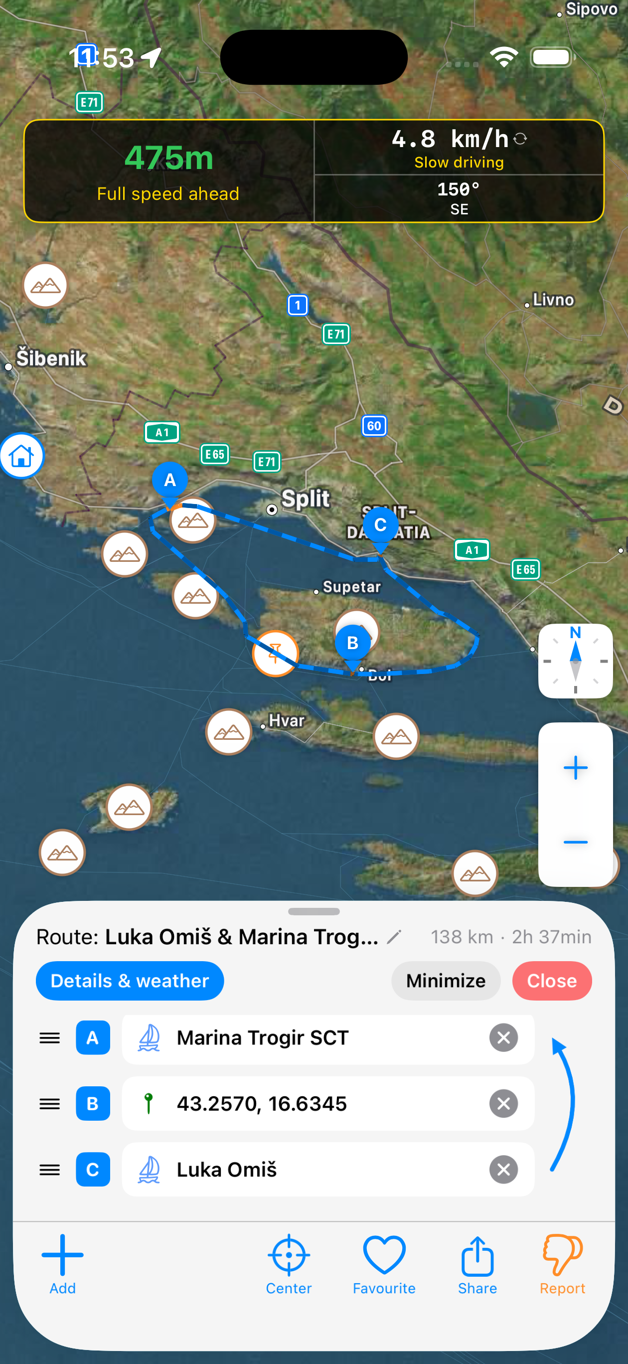
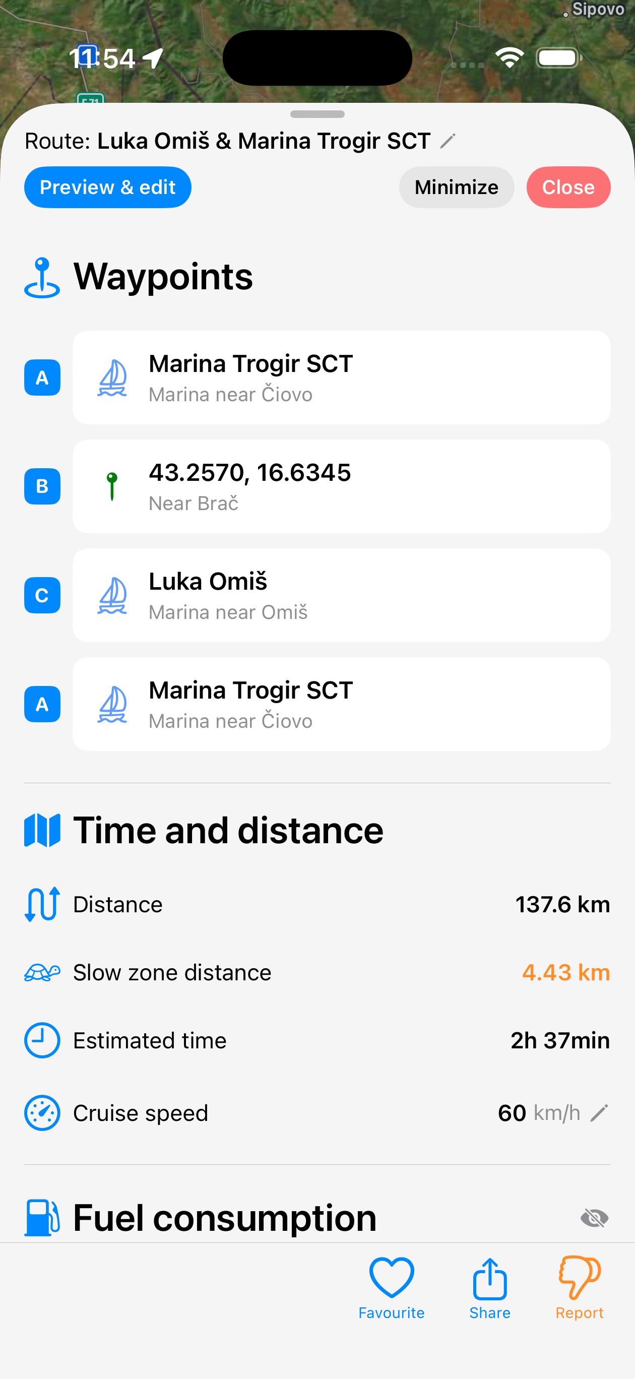
Route Planning
Get a fast path that aims to stay 300m+ from shore, with weather conditions along the route, fuel estimates, and easy sharing. See a sample route: Kornati & Telašćica →
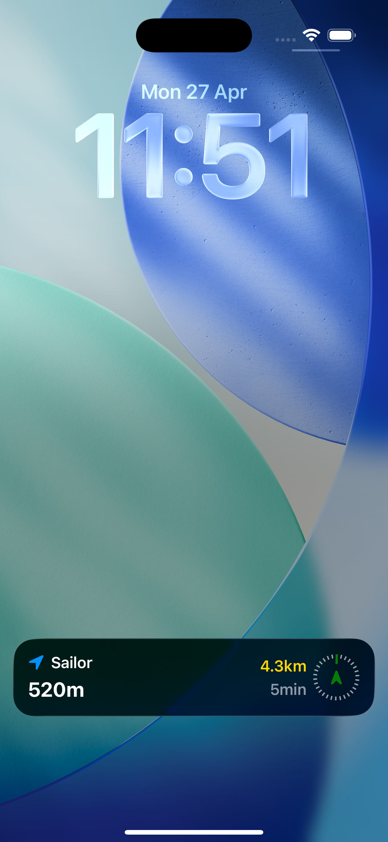
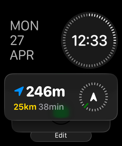
Lock Screen & Apple Watch
Glance at distance from shore and follow route progress on the lock screen or Apple Watch — no need to unlock your phone on the water.
Background Tracking
Track distance to coast while your phone is locked. Get notified if you get too close or move too fast.
Offline Areas
Download coastline data for specific areas. Distance-to-shore tracking and the Coastline Radar keep working without cellular signal — useful for remote sailing.
PRO Pricing
Prices may vary by region. Free features always available at no cost.
Frequently Asked Questions
What is Croatia's 300m boating rule?
In Croatia, motorboats must stay at least 300 metres from shore to travel above 8 knots. Sailor Croatia helps you stay aware of the boundary by showing your real-time distance to the nearest detected coastline and alerting you when you're moving too fast near shore.
Can Sailor Croatia work offline?
Yes. With a PRO subscription you can download coastline data for specific areas, so distance-to-shore tracking and the Coastline Radar keep working without cellular signal — useful when sailing in areas with poor coverage. The map background fills in as you explore — unvisited areas may appear blank at first, but the safety features (distance readout, speed alerts, Coastline Radar) don't depend on it.
Does Sailor Croatia work on Apple Watch?
Yes. With a PRO subscription, Sailor displays your distance to shore, current speed, compass bearing, and navigation progress on your Apple Watch and iPhone lock screen — so you can keep your eyes on the water.
What is the Coastline Radar feature?
The Coastline Radar (PRO) visualizes zones within 300 metres of the coast in every direction around your boat. It makes it easy to navigate narrow passages and stay compliant without constantly checking the distance readout.
How accurate is Sailor's distance-to-shore reading?
Sailor's readout is a close estimate, not a surveyed measurement. Like any navigation app, it depends on data and signals that can have errors or gaps, so we recommend keeping a comfortable margin rather than hugging the limit, and treating the app as guidance rather than ground truth. Our coastline data may not capture every islet, reef, breakwater, or other feature that the 300 m rule is measured against, and Sailor does not detect other vessels, swimmers, or marked zones nearby — a proper lookout remains essential. Even with those caveats, a live distance readout and zone overlay are far more reliable than judging distance by eye, where perception over open water is notoriously poor. Used alongside a proper lookout and official charts, Sailor takes most of the guesswork out of staying clear of the coastal slow zone.
Is Sailor Croatia free?
Sailor Croatia is free to download and includes core features: real-time distance to shore, speed tracking, heading display, weather forecast, real-time navigation, and map exploration. Advanced features including Coastline Radar, Route Planning, Background Tracking, Offline Areas, and Lock Screen Guidance require a PRO subscription.
Does Sailor have sea depth data?
No — Sailor has no bathymetric data. Routes and navigation do not account for water depth or your vessel's draft. Always verify depth with official nautical charts or a depth sounder before and during your voyage.
Try Sailor Croatia
A live distance-to-shore readout, coastal zone overlay, weather, and route planning — built for boating in Croatia.
⚠️ Safety notice. Sailor is a navigation aid, not a substitute for official charts, a proper lookout, or seamanship. Position, distance, and hazard data are estimates and may be inaccurate, delayed, or incomplete. Sailor has no sea depth data — always verify depth using official nautical charts or a depth sounder. You are solely responsible for safe operation of your vessel and for compliance with local maritime laws. Full terms apply.
Spotted a mismatch on the water? Send it through the in-app feedback form — we use those reports to refine the coastline data.
Support
Having an issue or a question? Contact us →